Trail Maps
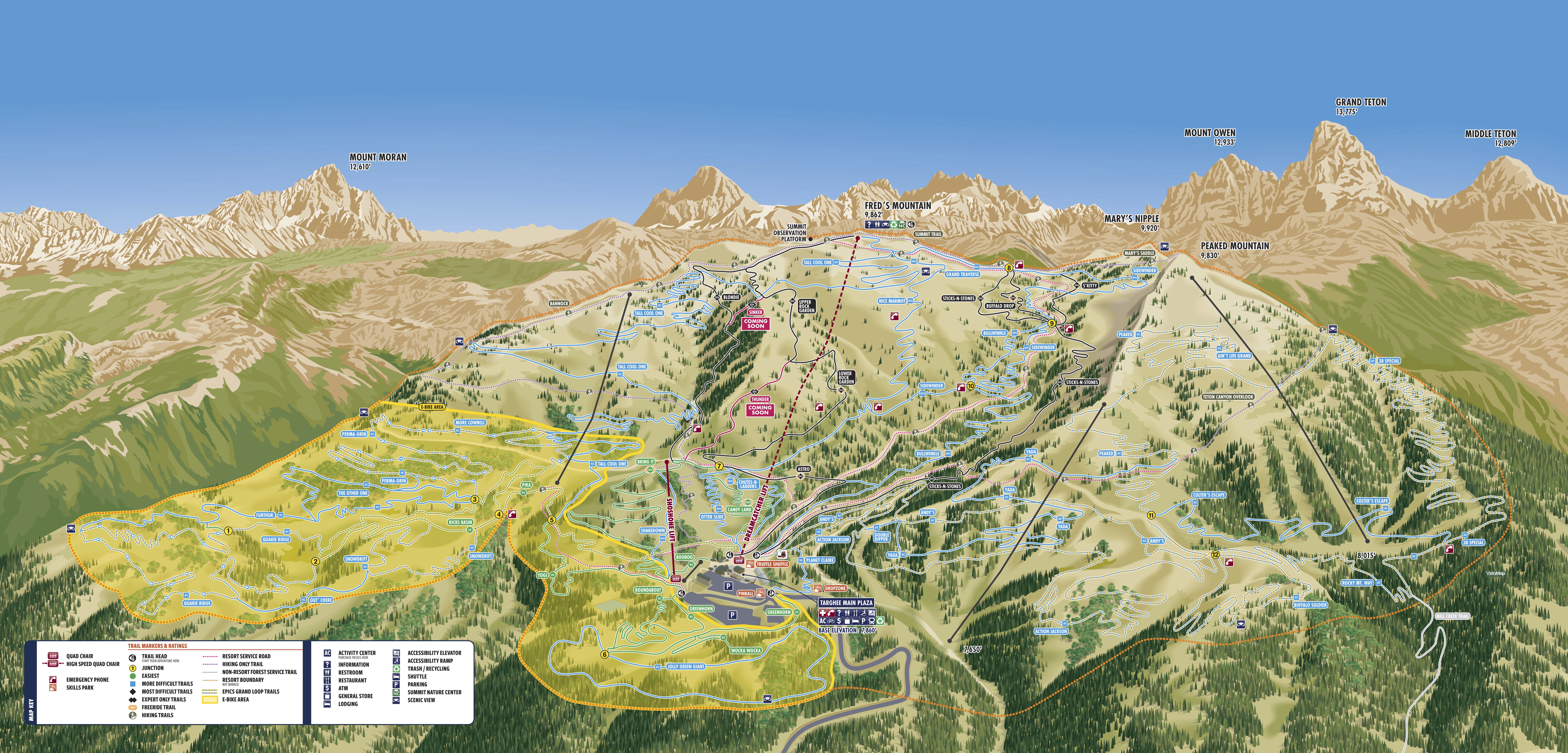
E-BIKE MAP
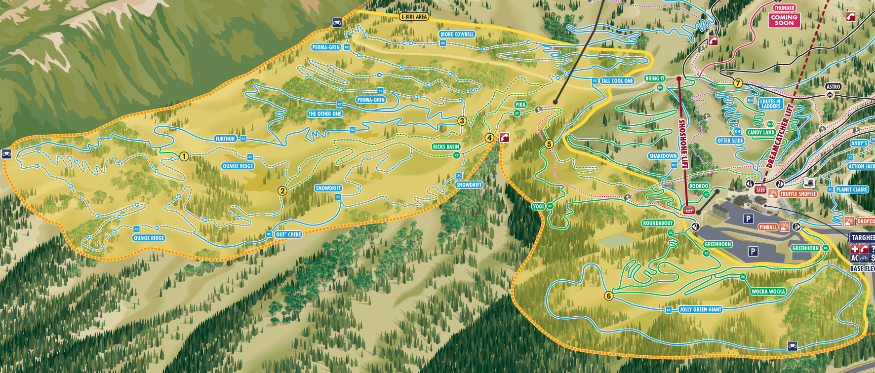
E-Bikes are allowed ONLY in the yellow highlighted area.
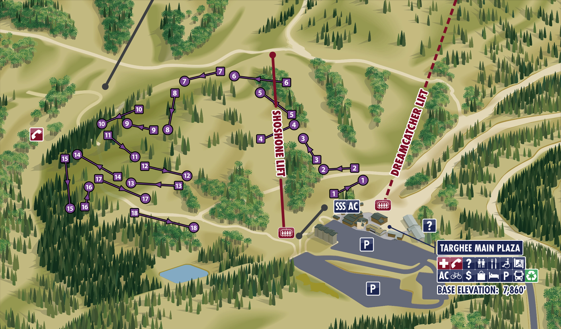
Summer Disc Golf Map
Interactive Summer Trail Map
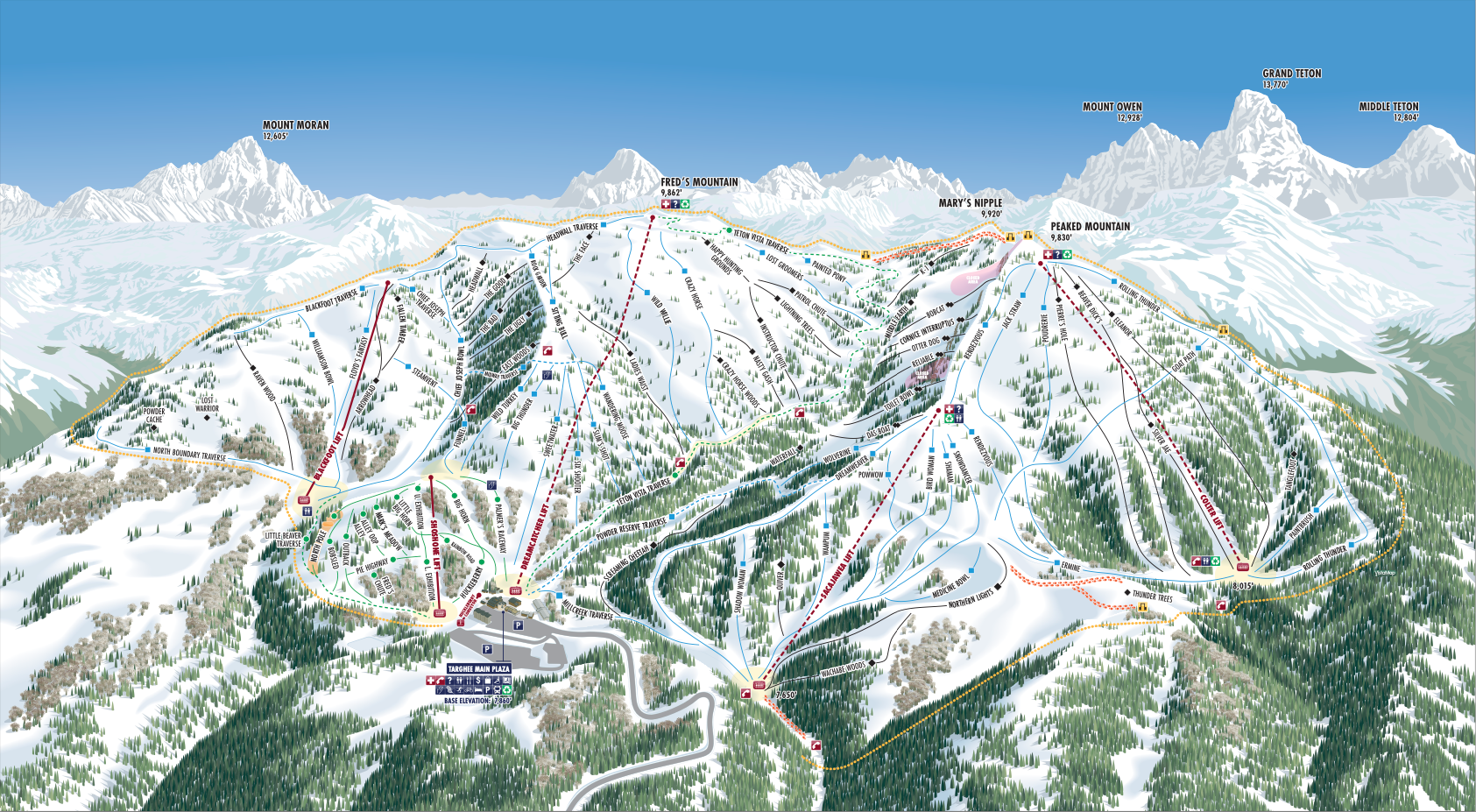
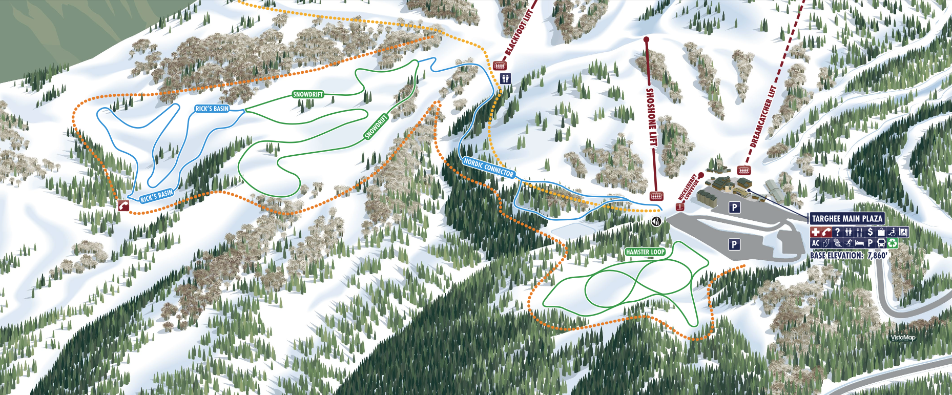
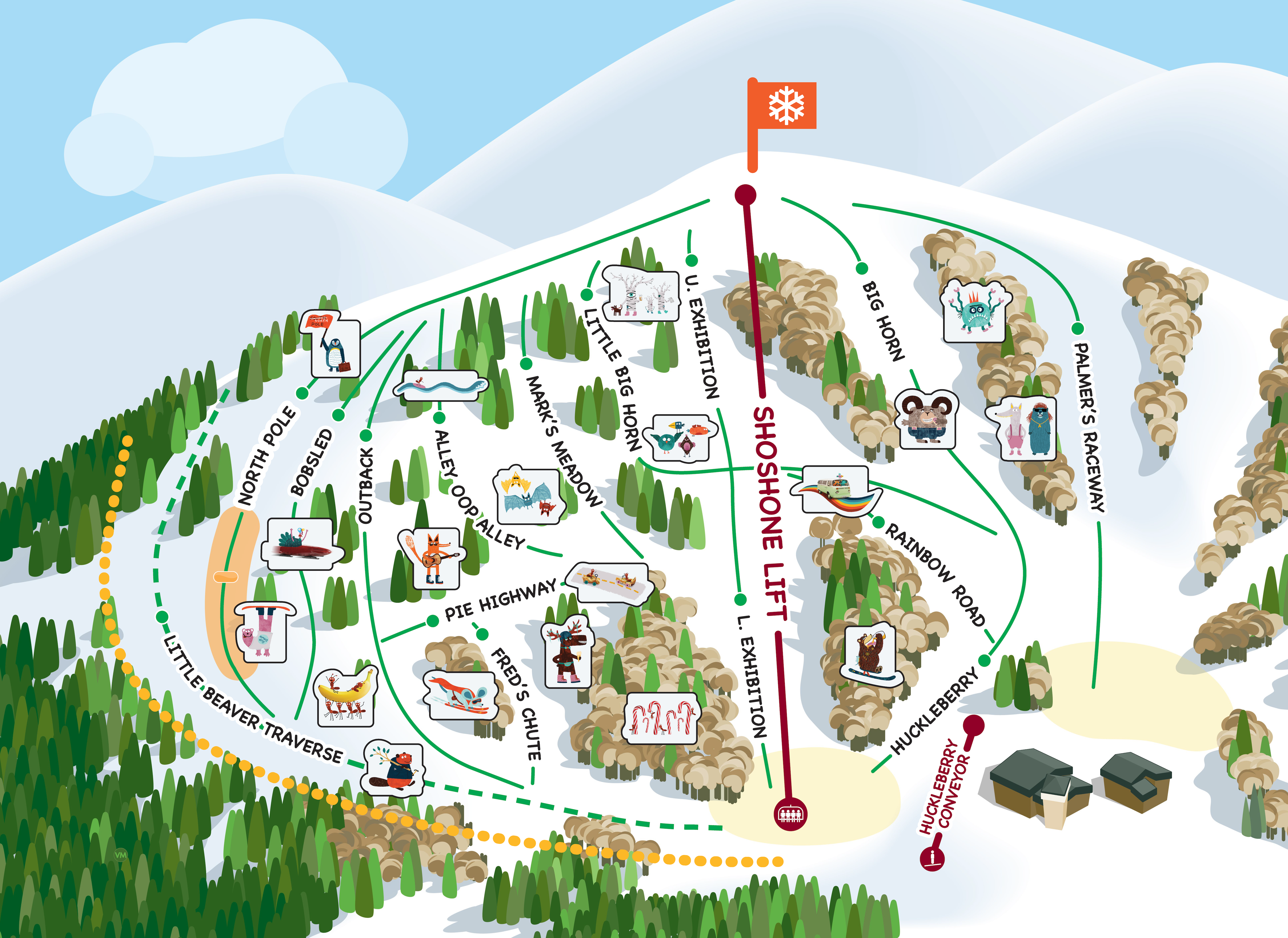
Skiers and riders be advised that a green circle, blue square or black diamond trail at your area is not necessarily the same as a similarly rated trail at another area. The system is a relative system that is valid only at this area. Skiers and riders should work their way up, beginning with the easiest trails no matter what their ability level may be, until they are familiar with the trails at the area.
Be advised that all poles and/or flags, fencing, signage and padding on equipment or objects or other forms of marking devices are used by the ski area to inform you of the presence or location of a potential obstacle or hazard. These markers are no guarantee of your safety and will not protect you from injury. It is part of your responsibility under Your Responsibility Code to avoid all obstacles or hazards, including those that are so marked.